

62
Sv. Vid (St. Vitus) - direction from Kolan
Kolan - Sv. Vid - Kolan
TRAIL DIFFICULTY
- average
© OpenStreetMap contributors
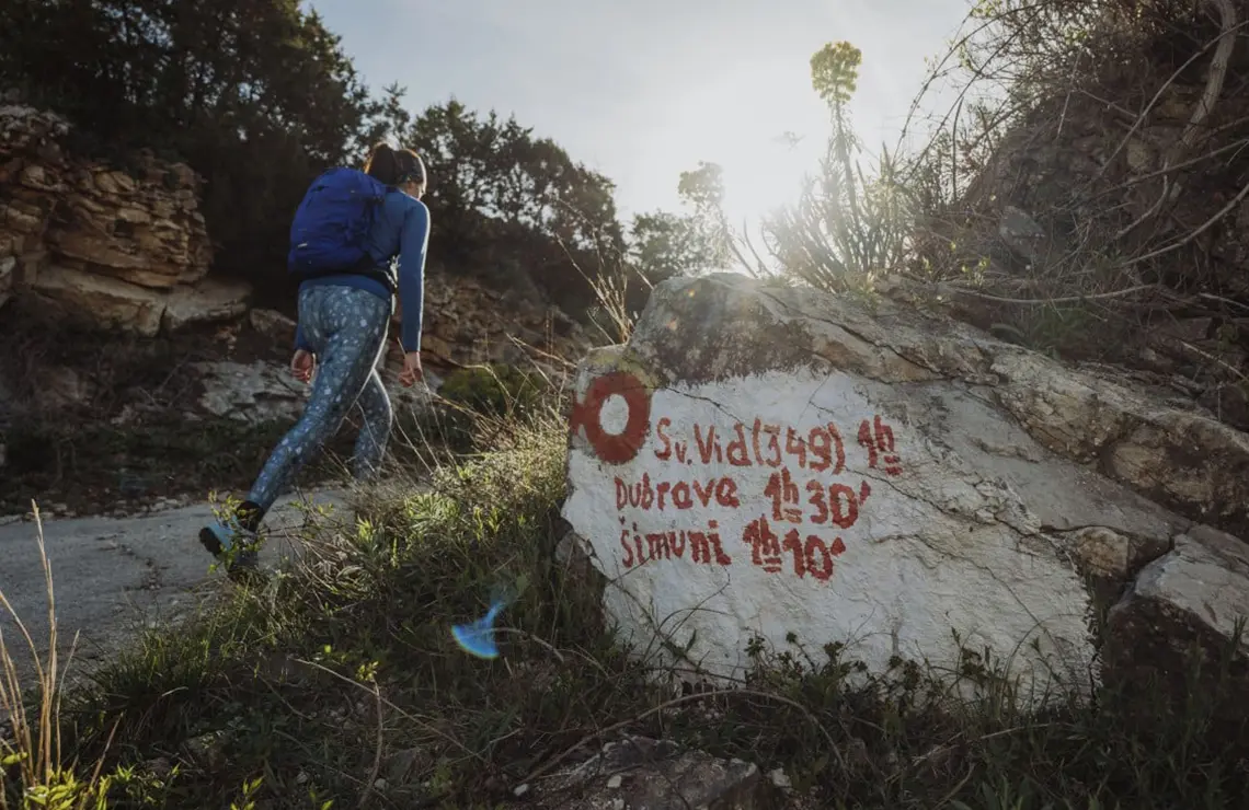
The trail to St. Vitus starts at the sharp curve of the main island road (D106) before Kolan (if you are coming from the town of Pag). The trail is marked, clear, and not all too challenging.
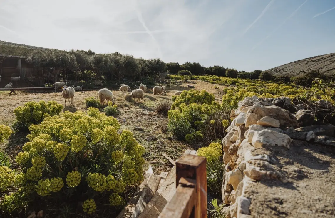
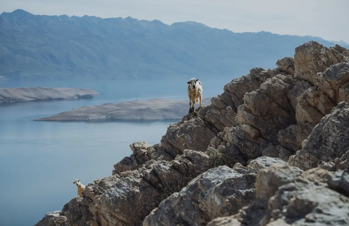
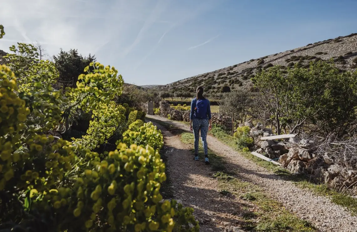
At the very beginning of the trail, you will pass through a green valley nestled between dry stone walls, karst pastures, and fences, where you will likely come across sheep grazing or just watching you curiously. On the ascending part of the trail, you will mostly find undergrowth and the occasional holm oak and cade juniper, and as you approach the very top, you will find fewer and fewer high shrubs and trees. Given that there is no shade on the trail, we recommend wearing protective clothing and shoes in the summer (to protect you from the sun) and bringing a lot of water. In winter, you should dress warmly as there is no lee on the trail.
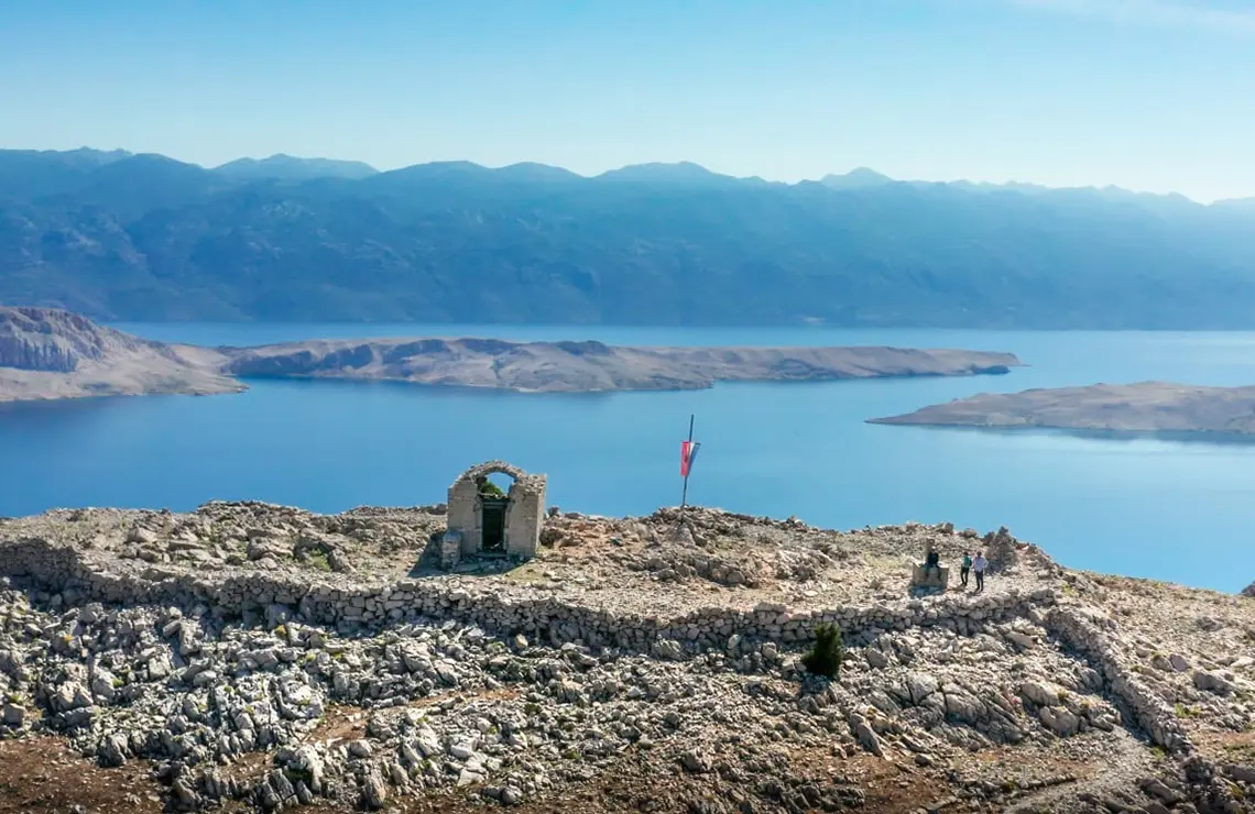
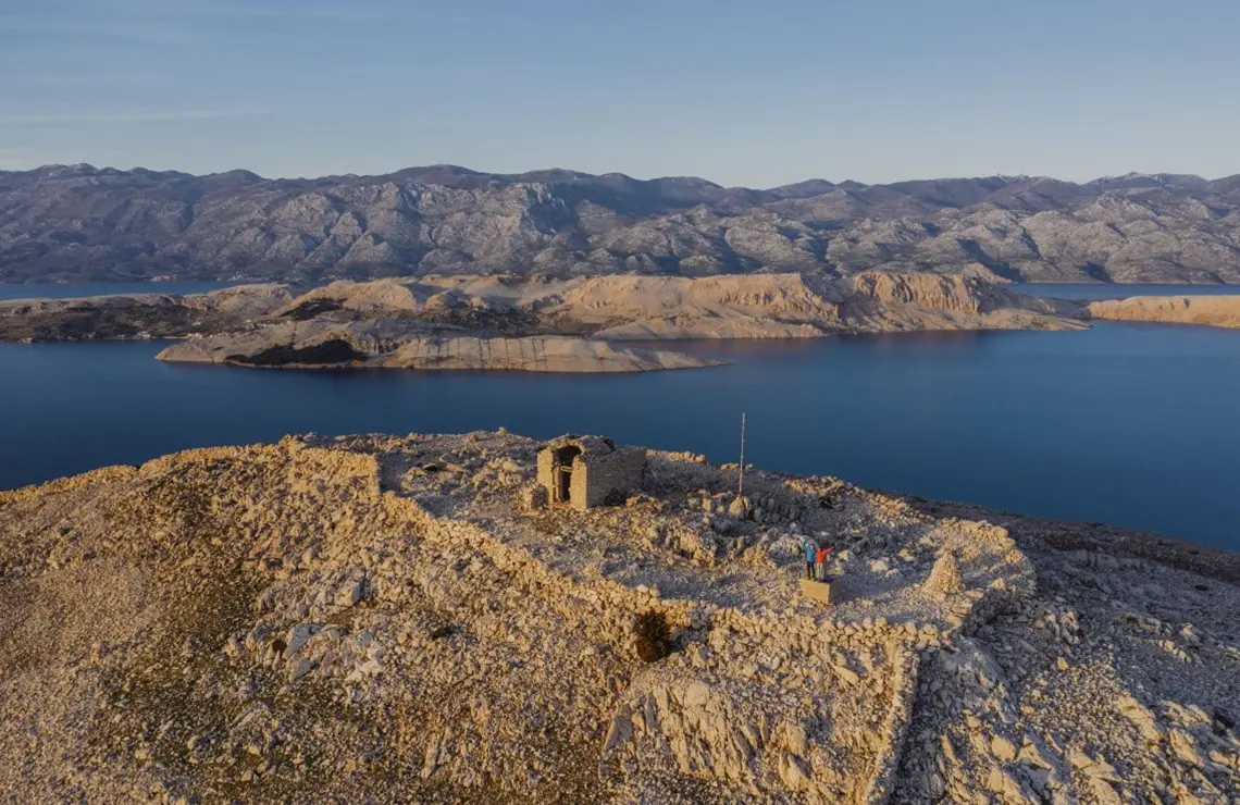
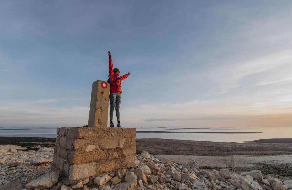
Although the trail is walkable all year round, it is at its most beautiful in the spring, when sage and other aromatic herbs that grow in abundance on the Pag rocks blossom. Except for the wonderful colours and smells, you will also enjoy the view of Velebit, Pag bay, the Pag gates, the surrounding islands, the town of Pag, and the distant salt pans.
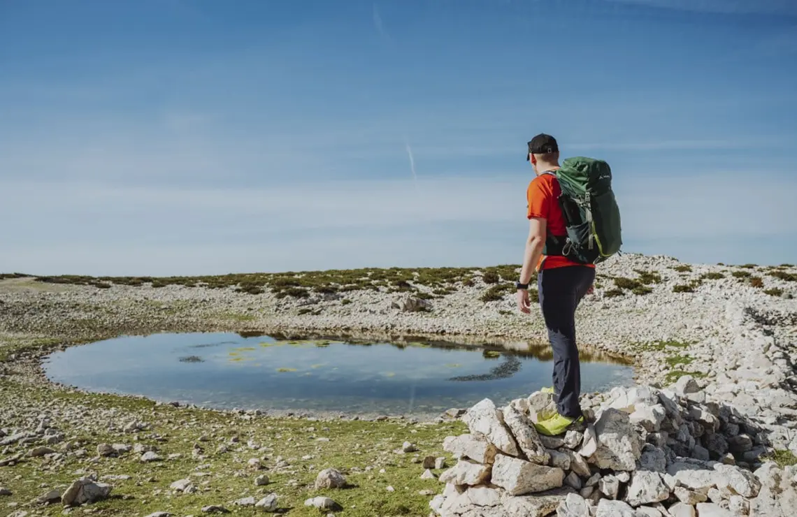
At the very top of the trail, you will find a puddle and a cross built of dry-stone walls. The location next to the church of St. Vitus at the top of the trail is ideal for taking some stunning photos – memories of a hike to the highest peak of the island of Pag.
starting point
finishing point
Kolan - road
44.48641 N | 14.96717 E
trail time
1:30 h
Kolan - road
44.48641 N | 14.96717 E